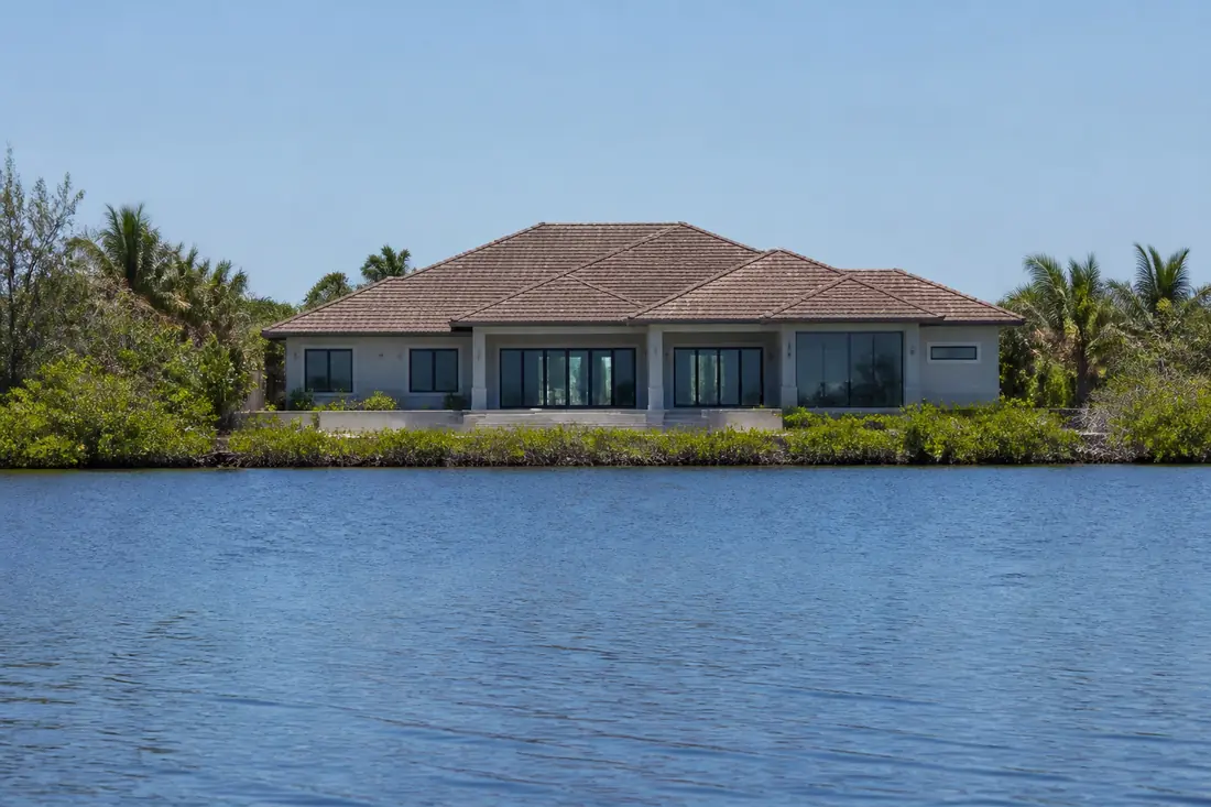
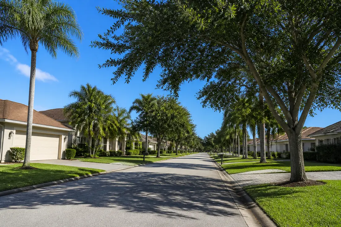
Two houses, both single-story, both built by the same builder in the same year, three quarters of a mile apart. One backs onto a wide basin. The other sits four streets inland among mature trees.
The same window package will not necessarily satisfy the code on both. And the reason has nothing to do with the houses, the county’s wind speed map or the products. It is the ground in front of them, measured in feet.
The code calls this exposure category, it is decided by Section 1609.4, and the rules are more mechanical than most people expect. Once you can read them, a design pressure schedule stops looking arbitrary.
Last reviewed: 17 September 2026 against the Florida Building Code, Building, 8th Edition (2023). Section numbers are from that edition; the Code is revised on a cycle and numbering moves, so confirm against the edition your jurisdiction has adopted.
Exposure is per direction, not per property
The first sentence of Section 1609.4 sets the frame: “For each wind direction considered, an exposure category that adequately reflects the characteristics of ground surface irregularities shall be determined for the site at which the building or structure is to be constructed.” Account is taken of variations in ground surface roughness “that arise from natural topography and vegetation as well as from constructed features.”
So exposure is not a single stamp on a lot. It is evaluated direction by direction, and a house can be one exposure looking west over water and another looking east into a subdivision.
Section 1609.4.1 makes the geometry explicit. For each selected wind direction, the exposure is determined for the two upwind sectors extending 45 degrees either side of that direction — and “the exposure resulting in the highest wind loads shall be used to represent winds from that direction.”
That last clause is the one to remember. Within the sector being examined, the worst case governs. A mostly sheltered sector with an open corridor through it does not average out.
Three descriptions of ground
Section 1609.4.2 defines surface roughness in three categories, and they are short enough to quote in full.
Surface Roughness B. “Urban and suburban areas, wooded areas or other terrain with numerous closely spaced obstructions having the size of single-family dwellings or larger.”
Surface Roughness C. “Open terrain with scattered obstructions having heights generally less than 30 feet. This category includes flat open country, and grasslands.”
Surface Roughness D. “Flat, unobstructed areas and water surfaces. This category includes smooth mud flats, salt flats and unbroken ice.”
Water is Roughness D. Not “can be,” not “in some circumstances” — it is the first thing after “flat, unobstructed areas” in the definition. On a peninsula laced with canals, rivers and open bays, that single word does more work than any other in the section.
Note also that roughness is about what is there, not about what it is called. A wooded area is Roughness B. A cleared lot waiting for development is not, and neither is the field behind it.
The distances that turn roughness into a category
Section 1609.4.3 converts roughness into an exposure category, and it does so with distances rather than descriptions.
Exposure B applies, for buildings with a mean roof height of 30 feet or less, where Surface Roughness B prevails in the upwind direction “for a distance of at least 1,500 feet.” For buildings taller than 30 feet mean roof height, the requirement rises to at least 2,600 feet, or 20 times the height of the building, whichever is greater.
Exposure C applies “for all cases where Exposure B or D does not apply.” It is the default, not a description.
Exposure D applies where Surface Roughness D prevails in the upwind direction for a distance of at least 5,000 feet, or 20 times the building height, whichever is greater. And then a second trigger that catches a great many Lee County properties: Exposure D “shall also apply where the ground surface roughness immediately upwind of the site is B or C, and the site is within a distance of 600 feet or 20 times the building height, whichever is greater, from an Exposure D condition as defined in the previous sentence.”
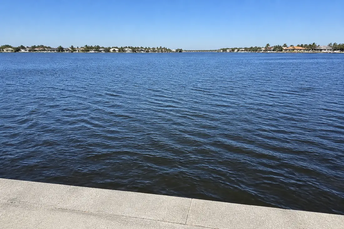
Read that last provision carefully, because it is the one that surprises people. You do not have to be on the water. If there is an Exposure D condition within 600 feet — for a low house, 600 feet is the governing figure, since 20 times the height is smaller — the site takes Exposure D even though the ground immediately upwind is suburban or open.
Six hundred feet is a short walk, and on a block of any length it is a poor thing to estimate by eye — measure the radius on an aerial rather than counting streets. That distance is the difference between the two houses at the top of this article, and neither owner chose it.
Why the default matters
Exposure C being the catch-all has a practical consequence worth spelling out.
Exposure B is not the normal case. It is a case you have to earn, by having at least 1,500 feet of genuinely suburban, wooded or comparably obstructed ground upwind — a quarter of a mile of houses or trees, in the direction being considered. A newer subdivision with young landscaping and open retention ponds may not deliver that in every sector.
So a house that feels sheltered can still be Exposure C, because it fails the distance test rather than the description test. And a house that is Exposure B looking north may be Exposure C looking south across a golf course.
Topography can override the simplified methods
Section 1609.1.1 requires wind loads to be determined under Chapters 26 to 30 of ASCE 7, then lists exceptions. Subject to Section 1609.1.1.1, ICC 600 is permitted for applicable Group R-2 and R-3 buildings, and AWC WFCM and AISI S230 are permitted for residential structures.
Section 1609.1.1.1 then limits those shortcuts. ICC 600 applies only to buildings located within Exposure B or C. And ICC 600, AWC WFCM and AISI S230 do not apply to buildings sited on the upper half of an isolated hill, ridge or escarpment meeting three conditions: the feature is 60 feet or higher in Exposure B, or 30 feet or higher in Exposure C; the maximum average slope of the hill exceeds 10 percent; and the feature is unobstructed upwind by other such topographic features for a distance from the high point of 50 times the height of the hill, or 1 mile, whichever is greater.
Southwest Florida rarely produces a hill that qualifies. The reason to know the rule anyway is the first half of it: a site in Exposure D cannot use ICC 600 at all. The simplified prescriptive path closes, and the design goes to ASCE 7. That is a real cost and schedule difference on a project, and it follows automatically from an exposure determination somebody made early.
What this does to a window schedule
Design pressures scale with exposure. The product does not change; the requirement the product has to meet does.
Which makes a rating quoted without an exposure category meaningless. A window described as “rated for 150 mph” has been given a wind speed and no terrain, and those are two of the several inputs that produce a design pressure.
The speed on its own is not even one number. The figures on the maps are ultimate design wind speeds, V-ult, and Section 1609.3.1 provides a conversion to nominal design wind speeds, V-asd, using Table 1609.3.1 or Equation 16-17 — though Section 1609.1.1 applies that conversion only where the standards in its Exceptions 4 and 5 are used, which are metal flagpoles and antenna-supporting structures rather than houses. The residential standards set their own basis.
What that means at a data sheet is simply that two wind speed conventions exist, they are not interchangeable, and neither of them is a pressure. Exposure category, the zone the opening sits in, its size and the building’s geometry all stand between a speed and a pressure.
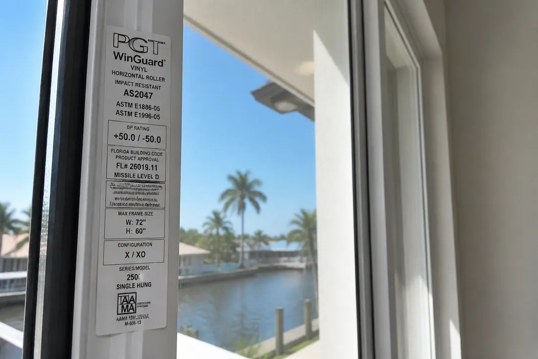
Section 1609.1.2 is a separate requirement running alongside it: in wind-borne debris regions, glazed openings in buildings must be impact resistant or protected with an impact-resistant covering meeting ANSI/DASMA 115 for garage doors and rolling doors, or TAS 201, 202 and 203, AAMA 506, ASTM E1996 and ASTM E1886 as referenced, or an approved impact-resistant standard.
Impact resistance and design pressure are different tests answering different questions. Exposure category drives the second, not the first. A window can be fully impact rated and still be under-rated for pressure at your address.
The Code’s own definitions keep these separate too. A wind-borne debris region is defined in Chapter 2 as areas within hurricane-prone regions identified by figure, with Figure 1609.3(1) governing the general case, Figure 1609.3(2) for Risk Category III health care facilities and Figure 1609.3(3) for Risk Category IV. And it defines wind speed V-ult as ultimate design wind speed and V-asd as nominal design wind speed — two different numbers that are easy to confuse when reading a data sheet.
What a professional looks at, in order
The site on an aerial, with a circle at 600 feet. Any open water or comparably unobstructed surface inside it puts Exposure D on the table immediately.
Each wind direction separately. Two 45-degree sectors per direction, per Section 1609.4.1, with the worst case governing.
The 1,500 foot test for Exposure B. Whether genuinely obstructed terrain prevails that far upwind, in the sector being considered.
The mean roof height. It changes the Exposure B distance from 1,500 to 2,600 feet above 30 feet, and it enters the 20-times-height comparisons.
Whether ICC 600 is available. In Exposure D it is not, and that changes who does the design.
Common mistakes
Reading exposure off a neighbor’s permit. Exposure is per site and per direction, and 600 feet separates a great many Lee County houses from a different answer.
Assuming a suburban street is Exposure B. Exposure C is the default. Exposure B has a distance test that a newer or sparser development may fail.
Confusing impact rating with design pressure. Section 1609.1.2 and Section 1609.4 are asking different questions, and passing one says nothing about the other.
Treating a mangrove fringe or a row of palms as an obstruction. Surface Roughness B describes “numerous closely spaced obstructions having the size of single-family dwellings or larger.” A tree line at the water’s edge is not that.
Letting exposure be assumed rather than determined. It is an input to every pressure in the schedule, and once the products are ordered it is expensive to revisit.
What drives the cost
There is no meaningful per-opening price without knowing the exposure category, the mean roof height, the design wind speed at the address and the size and location of each opening. Corner and edge zones carry higher pressures than the middle of a wall, which is why two windows of the same size in the same house can need different ratings.
Exposure is the input that moves the whole schedule at once. Going from B to C, or C to D, raises the requirement on every opening rather than on one.
Before you order windows
Ask what exposure category the quote assumes, and on what basis. “Exposure C” with no reasoning behind it is a guess that will be checked at permit.
Look at your own address on an aerial image and measure 600 feet in every direction. If open water falls inside that circle, raise it before the order rather than after.
Ask for the design pressure required per opening, not a single figure for the house. Openings differ by size and by where they sit on the elevation.
And keep the product labels and approval numbers. Section 1609.1.2’s impact requirement and the pressure requirement are documented separately, and the wind mitigation paperwork that follows the job draws on both.
The sequence that saves money is to settle the exposure category before anyone quotes, because it is the single input that changes every line of the schedule. A quote priced on the wrong exposure is not a cheaper quote; it is a different scope.
This guide explains building code requirements in plain language and is not legal advice or an engineering determination. The code edition adopted by your jurisdiction, and the building official’s or design professional’s determination for a specific property, control what is actually required.
Sources
- Florida Building Code, Building, 2023, Chapter 16 — Structural Design. Determination of wind loads and the ICC 600, AWC WFCM and AISI S230 exceptions at Section 1609.1.1; the Exposure B or C limitation and the isolated hill, ridge or escarpment conditions — 60 feet in Exposure B, 30 feet in Exposure C, 10 percent maximum average slope, and 50 times the height or 1 mile unobstructed — at Section 1609.1.1.1; protection of openings and the referenced impact standards at Section 1609.1.2; exposure category and the account taken of topography and vegetation at Section 1609.4; the two 45-degree upwind sectors and the governing worst case at Section 1609.4.1; the conversion of ultimate design wind speed to nominal design wind speed, V-asd, by Table 1609.3.1 or Equation 16-17 at Section 1609.3.1, which Section 1609.1.1 applies only where the standards in its Exceptions 4 and 5 are used; Surface Roughness B, C and D at Section 1609.4.2; and the Exposure B 1,500 foot and 2,600 foot distances, Exposure C as the default, and the Exposure D 5,000 foot and 600 foot triggers at Section 1609.4.3.
- Florida Building Code, Building, 2023, Chapter 2 — Definitions. The definition of a wind-borne debris region and its reference to Figures 1609.3(1), 1609.3(2) and 1609.3(3); and the definitions of wind speed V-ult (ultimate design wind speeds) and V-asd (nominal design wind speeds).